


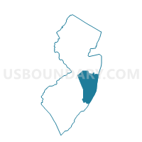
Berkeley township ward 1 voting district 34, Ocean County, New Jersey
About
Outline

Summary
| Unique Area Identifier | 621227 |
| Name | Berkeley township ward 1 voting district 34 |
| County | Ocean County |
| State | New Jersey |
| Area (square miles) | 5.11 |
| Land Area (square miles) | 1.41 |
| Water Area (square miles) | 3.71 |
| % of Land Area | 27.49 |
| % of Water Area | 72.51 |
| Latitude of the Internal Point | 39.92095780 |
| Longtitude of the Internal Point | -74.11147110 |
Maps


Graphs
Select a template below for downloading or customizing gragh for Berkeley township ward 1 voting district 34, Ocean County, New Jersey


Neighbors
Neighoring Voting District (by Name) Neighboring Voting District on the Map
- Berkeley township ward 1 voting district 2, Ocean County, NJ
- Berkeley township ward 1 voting district 3, Ocean County, NJ
- Berkeley township ward 1 voting district 4, Ocean County, NJ
- Berkeley township ward 1 voting district 7, Ocean County, NJ
- Dover township voting district 31, Ocean County, NJ
- Dover township voting district 7, Ocean County, NJ
- Island Heights borough voting district 1, Ocean County, NJ
- Ocean Gate borough voting district 1, Ocean County, NJ
- Seaside Park borough voting district 1, Ocean County, NJ
- Seaside Park borough voting district 2, Ocean County, NJ
Top 10 Neighboring County Subdivision (by Population) Neighboring County Subdivision on the Map
- Toms River township, Ocean County, NJ (91,239)
- Berkeley township, Ocean County, NJ (41,255)
- Ocean Gate borough, Ocean County, NJ (2,011)
- Island Heights borough, Ocean County, NJ (1,673)
- Seaside Park borough, Ocean County, NJ (1,579)
Top 10 Neighboring Place (by Population) Neighboring Place on the Map
Top 10 Neighboring Elementary School District (by Population) Neighboring Elementary School District on the Map
- Berkeley Township School District, NJ (41,255)
- Ocean Gate Borough School District, NJ (2,011)
- Island Heights Borough School District, NJ (1,673)
- Seaside Park Borough School District, NJ (1,579)
Top 10 Neighboring Secondary School District (by Population) Neighboring Secondary School District on the Map
Top 10 Neighboring Unified School District (by Population) Neighboring Unified School District on the Map
Top 10 Neighboring State Legislative District Lower Chamber (by Population) Neighboring State Legislative District Lower Chamber on the Map
Top 10 Neighboring State Legislative District Upper Chamber (by Population) Neighboring State Legislative District Upper Chamber on the Map
Top 10 Neighboring 111th Congressional District (by Population) Neighboring 111th Congressional District on the Map
Top 10 Neighboring Census Tract (by Population) Neighboring Census Tract on the Map
- Census Tract 7280, Ocean County, NJ (5,072)
- Census Tract 7310.02, Ocean County, NJ (3,791)
- Census Tract 7310.01, Ocean County, NJ (3,559)
- Census Tract 7311.01, Ocean County, NJ (3,059)
- Census Tract 7235, Ocean County, NJ (2,560)
- Census Tract 7290, Ocean County, NJ (2,010)
- Census Tract 7260, Ocean County, NJ (1,673)
- Census Tract 9800, Ocean County, NJ (5)
Top 10 Neighboring 5-Digit ZIP Code Tabulation Area (by Population) Neighboring 5-Digit ZIP Code Tabulation Area on the Map
- 08753, NJ (63,678)
- 08721, NJ (20,512)
- 08751, NJ (4,212)
- 08752, NJ (2,074)
- 08740, NJ (2,010)
- 08732, NJ (1,484)